
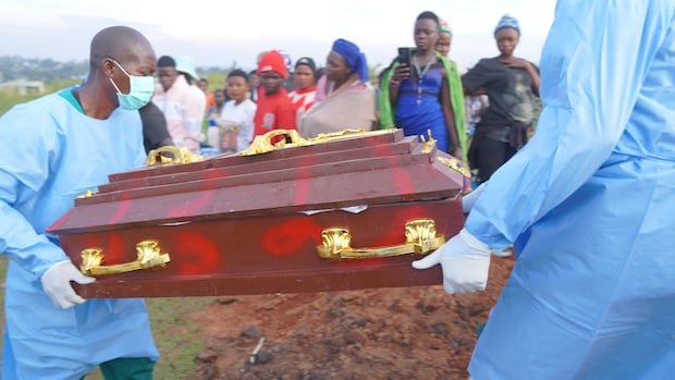

Health authorities combatting the Ebola crisis in eastern Democratic Republic of Congo are utilizing de-identified mobile phone data to track population movements and pinpoint potential areas of virus transmission, as per the World Health Organization (WHO) and affiliated researchers.
In a novel approach unprecedented in Ebola responses, this initiative is crucial as officials grapple with what the WHO has labeled the most rapidly escalating Ebola outbreak on record. With cases confirmed in six provinces and over 6,250 individuals infected and 3,039 fatalities since the outbreak’s declaration on May 15, the urgency is paramount, based on the latest government statistics.
This 17th Ebola outbreak in Congo is triggered by the Bundibugyo strain of Ebola, for which no sanctioned vaccines or treatments exist.
With the virus spreading, health officials are seeking proactive measures to predict potential outbreak areas and efficiently allocate surveillance and response resources.
Olivier Le Polain, in charge of epidemiology and analytics for response at the WHO Health Emergencies Programme, emphasized the significant role of population movements in outbreaks, especially in the current epidemic.
Conventional risk assessments concentrate on outbreak epicenters and assume the virus would predominantly disseminate to nearby regions. By analyzing mobility data, responders can pinpoint risks in distant areas closely linked through travel patterns, offering a more nuanced risk assessment.
For instance, in Ituri province, where the outbreak is believed to have originated, substantial population movements tied to mining activities and trade underscore the necessity of understanding these movements for gauging outbreak spread.
The analysis, conducted by Swedish non-profit Flowminder, leverages anonymized data generated when mobile phone users connect to telecommunication networks. By tracking these connections, researchers estimate people’s travel patterns across various regions.
The data, provided at no cost by Vodacom, the largest telecom operator in Congo, remains aggregated and anonymized, ensuring individual subscriber identification is inaccessible.
Flowminder founder, Linus Bengtsson, stressed the importance of estimating people’s movements as a precursor to tracking infectious individuals.
Initial analysis by Flowminder in early June focused on outbreak origin areas like Bunia, Mongbwalu, and Rwampara, tracing travel patterns of individuals present in those areas between April 3 and April 23.
The expanded analysis by Flowminder encompassed additional affected regions as the virus spread beyond its initial focal point, identifying likely travel destinations for individuals leaving hotspots.
Kisangani, a pivotal transport hub on the Congo River connecting eastern and western Congo, emerged as a notable location at risk, prompting preemptive operational reinforcements based on data insights before confirmed cases surfaced.
Recent studies have underscored connections between Kisangani and Kinshasa, as well as settlements along the Congo River and areas near borders with Central African Republic and South Sudan, emphasizing the risk of spread to Congo’s capital and major city.
As the WHO issues warnings about outbreak expansion to Kinshasa and neighboring nations, modeling exercises suggest a 70% likelihood of a case detection in Kinshasa by the end of September.
Despite its utility, the analysis’s limitations include reliance on data solely from Congolese mobile networks, offering a restricted view of cross-border movements. Efforts are underway to collaborate with other telecom operators to enhance coverage and obtain more comprehensive data for a more robust response strategy.