
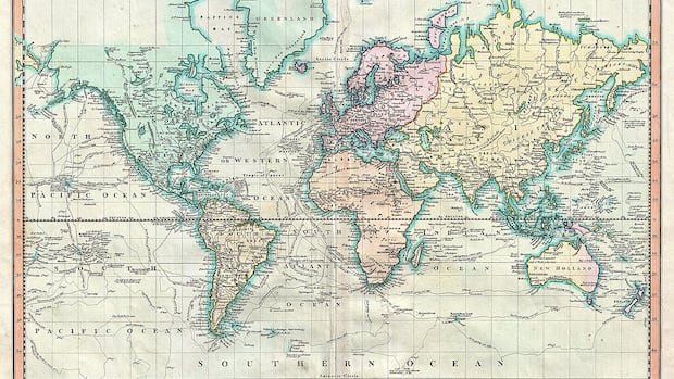

The United Nations made a significant decision on Friday to transition from the outdated Mercator global map to a more precise representation of countries’ actual sizes. This resolution, spearheaded by African nations, aims to combat the misconception that Africa is on the fringes of the world map.
Togo took the lead in advancing the African Union’s push to reduce the use of the Mercator map, known for distorting the proportions of land masses by exaggerating those closer to the poles. This distortion makes Greenland seem comparable in size to Africa, despite Africa being approximately 14 times larger.
“A just world begins with an equitable map,” stated Togo’s Foreign Minister Robert Dussey before the vote. The resolution endorses the Equal Earth projection, which provides a more accurate depiction of continent sizes.
Although not legally binding, the resolution emphasizes that it does not challenge the suitability of the Mercator projection for maritime and aerial navigation. The Togolese ministry clarified that the Mercator projection remains well-suited for such purposes.
The resolution passed in the UN General Assembly with overwhelming support, receiving 164 votes in favor, one against (from the United States), and six abstentions. The U.S. criticized the resolution, labeling it as promoting an ideological agenda and diverting attention from genuine global issues.
Togo aims to update its school geography materials by the end of the year, becoming the first country to do so. Dussey expressed the importance of leading by example and encouraging other nations to follow suit in transitioning away from the outdated Mercator projection.
In the coming months, Togo plans to engage with African Union members and allies from various regions to facilitate broader adoption of the Equal Earth projection. Dussey emphasized the need for discussions with mapping companies, GPS providers, and other tech firms to support this transition.
Dussey underscored that this initiative aligns with broader African efforts to address colonial-era legacies and is not intended as an attack on any specific civilization. He highlighted the historical context behind the widespread use of the Mercator map, emphasizing that both the world and Africa are evolving.