
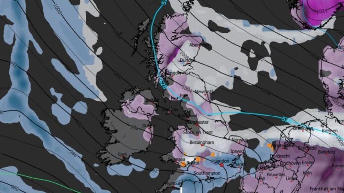

Advanced weather modeling indicates that a significant weather event could impact the UK in early February. The GFS weather model predicts snow and rain across the country on February 4, with snow covering areas from southern England to northern Scotland. Wales and Northern Ireland are also expected to see snowfall.
The weather maps highlight purple areas where snow is expected to settle in major cities like Southampton, London, Birmingham, Nottingham, Cardiff, Norwich, Newcastle, Edinburgh, and Glasgow. In addition to snow, there are concerns about freezing rain, depicted by orange patches on the maps. Freezing rain is forecasted to hit South Wales, Gloucestershire, Buckinghamshire, and later central Wales on February 4.
The Met Office explains that freezing rain is a rare form of liquid precipitation that freezes rapidly upon contact with cold surfaces. It forms when snow turns into rain after passing through warmer air, then becomes supercooled upon encountering colder air, remaining in liquid form despite being below 0°C. When this supercooled rain hits the ground, it instantly freezes, creating a layer of clear ice.
The weight of ice from freezing rain can have severe consequences, including tree and power line damage, hazardous road conditions, and risks to aviation. A past Met Office case study from 1996 highlighted the devastating impact of freezing rain on Wales, the south-west, and the Midlands, leading to increased accidents and hospitalizations. Fortunately, the freezing rain forecasted for February 4 is not expected to be as widespread or prolonged as in 1996.