
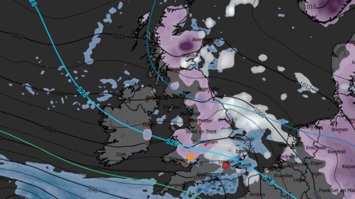

New snow maps for the UK have detected a cold front rapidly approaching the nation, poised to bring snow across extensive regions with the likelihood of rare freezing rain in some areas.
Although temperatures have slightly increased lately, remaining in the low single digits, the conclusion of the winter season for 2025/26 is marked by more turbulent weather conditions. Heavy wind and rain have been prevalent across the country since the previous week.
According to weather forecasts, the unsettled weather conditions are expected to persist in the initial days of February 2026, accompanied by unusual phenomena like freezing rain as temperatures drop below zero.
Recent data from WXCharts indicates the arrival of an Arctic system before Valentine’s Day on February 13, potentially blanketing 601 miles from the north to the south of the UK with snow. While the snow accumulation is projected to be minimal, the conditions may lead to significant freezing rain in localized areas.
Freezing rain is anticipated to affect southern Wales, particularly areas like Newport, Cardiff, Carphilly, Cwmbran, Pontypool, Merthur Tydfil, and Ebbw Vale as temperatures plummet to -4°C. The freezing rain is expected to be short-lived, ceasing by 6pm on the same day, with an approximate rate of 0.1mm per hour. Subsequently, the rain will transition to normal rainfall upon reaching Bristol.
The snow cover is forecasted to persist over the country for several days, likely until February 15, as per the extended outlook from the Met Office. The long-range forecast from February 6 to 15 warns of upcoming rain and colder temperatures.
The Met Office forecast outlines, “Frontal systems originating from the Atlantic may lead to periods of rain, particularly in flood-sensitive areas, as they encounter high-pressure regions to the north and northeast. This could result in snowfall in northern England and Scotland, mainly at higher elevations, due to colder air masses.”
As February progresses, a potential shift southward of low-pressure areas could bring colder air across wider regions of the UK, heightening the risk of wintry conditions.
Before this anticipated change, wintry hazards are expected, with yellow weather warnings issued by the Met Office for ice and rain until February 2 and 3 in the southwest, posing risks of fog and slippery surfaces.